1.

The D'Entrecasteaux Channel and Huon Estuary

Like nowhere else on earth

The picturesque D'Entrecasteaux Channel and lower Huon Estuary support a range of habitats and species, and together represent Australia's southern-most body of sheltered waters. The Huon Estuary's tannin-rich waters create where low light conditions create a very special marine environment that supports sea life usually only found in much deeper waters. Natural, social, cultural and economic values are the key to why this waterway is one of the most important multi-use waterways in Tasmania. The D'Entrecasteaux Channel and Huon Estuary are a cornerstone of the Tasmania's tourism and primary production industries – supporting thriving businesses, commercial operators and growing residential development.

Coastal land use

The coastline is being modified by residential, agricultural, recreational, tourism, and industrial uses. In particular, there has been a trend for increasing residential use and production forestry, with a 28% decrease in natural environments. However, land up to 1 km inland of the waterway is still dominated by natural environments (42%), with other major uses including residential land (26%), pasture (17%), production forestry (6%) and transport and communication (4%). Smaller areas are dedicated to manufacturing, agriculture and other uses (<2% each).

Population and tourism

Almost 53,000 people live in the combined Kingborough-Huon region. Over the last 10 years there has been a 15.2% population increase. Tourism is also growing in the region, and over the last nine years, a popular circuit within the Huon region has seen a 34.4% increase in visitor numbers, a statistic which could be broadly applied across the southern region.

Population and tourism

Climate trends

Representative climate data from Dover shows a slight decrease in rainfall from 2012 to 2016 (0.3% lower than the long-term average) and an increase in mean minimum and maximum temperatures within the region (3-3.5% warmer).

Climate

Climate change

Climate change is predicted to significantly impact infrastructure, natural ecosystems, heritage values and industries of the waterway and adjoining coast. The capacity of the region to adapt is being evaluated through climate change adaptation planning in the Kingborough and Huon Valley municipalities. The Councils have many projects prioritising works on coastal assets, monitoring the coastline, building knowledge, managing coastal protection and adaptation of cliff erosion. They are also involved in emission reductions and transitioning to clean energy. Shoreline monitoring is continuing at seven sites in the region as part of the TASMARC program to assess changes in the shape and position of beaches.

Climate change

Caring for our waterway

Representatives from industry, government and natural resource organisations work in partnership to collect and review data and reports on the condition of the waterway. This ‘D’Entrecasteaux and Huon Collaboration’ involves people in on-ground action, and assists the community to be better informed, whilst developing and implementing strategic and practical solutions that improve and protect the waterway's condition, liveability, productivity and biodiversity to ensure a healthy and productive waterway shared by all.

The D'Entrecasteaux and Huon Collaboration is a partnership supported by the Derwent Estuary Program, Huon Aquaculture, Huon Valley and Kingborough Councils, NRM South, Tassal and TasWater. Each organisation has technical expertise, knowledge, information and networks that can be used to assist each other and achieve greater outcomes.

Caring for our waterway
2.

Waterway use

The D'Entrecasteaux Channel and Huon Estuary are popular areas for swimming, scuba diving, beach combing and bushwalking. These waterways host the highest numbers of recreational fishers and boaters in Tasmania. The key target fish species for recreational fishing include flathead, Australian salmon, Atlantic salmon, sea-run trout, barracouta, bream, mullet, squid, pike and flounder. Commercial fisheries largely comprise shellfish and salmon industries.

Swimming in the waterway

For the last two summers, water quality has been monitored at across the Kingborough municipality. Overall, water quality , although water quality declines significantly in urban areas after heavy rains. Swimming is not recommended in high runoff areas for several days after heavy rain and never near stormwater or urban rivulets.

Boating and fishing

The D'Entrecasteaux Channel and Huon Estuary are the most popular waterways in Tasmania for boating and fishing. A 2010 survey estimates 15% of all boating activity in Tasmania is in the Channel and Huon. While many recreational and commercial activities on and around the waterway contribute to the lifestyle and prosperity of the region, careful management is required to avoid negative environmental consequences from these activities. Boating and fishing activities may result in inputs such as sewage, hull fouling waste, oil and litter, can cause habitat disturbance and can lead to population declines in local fisheries.

Fisheries and Reserves

The waterway has areas designated for marine farming (shellfish and finfish) and for conservation (marine reserves). The waterway has a total area of 44,600 ha, including 6,239 ha of marine reserve, 3,479 ha of marine farming zones (finfish and shellfish) and 1,129 ha of active aquaculture leases. There has been a 6% increase in marine farming zoning since 2016, but a decline in active shellfish and finfish leases.

Moorings in the D'Entrecasteaux Channel and Huon Estuary

Demand for moorings continues to grow across Tasmania, and the D'Entrecasteaux and Huon waterways are no exception. Creation of new moorings poses additional challenges to waterway management as moorings may affect local habitats and create point sources for pollution.

The number of boat moorings in the Channel/Huon in 2017 was 1,640, and has increased by 23% over the past 5 years.

Recreational fishing

The recreational catch of abalone in 2016-2017 has nearly doubled when compared to catch statistics from two years earlier (up by 48%). Annual lobster catches have declined by 2%. Flathead are showing signs of low-level stock rebuilding in the Channel. The recreational scallop fishery has remained closed since 2012 due to overfishing and poor recruitment. There has been no recovery of commercial or doughboy scallops but some recovery of queen scallops. The abalone peak recorded in 2012/2013, may to be due to extrapolation of data from a small number of records, rather than reflecting significant trends.

Commercial fishing - Abalone

Commercial fishing is limited to a small amount of abalone, with annual catches increasing in 2016 (22 tonnes). This increase was due to the lifting of some restrictions on commercial fishing following precautionary closures due to biotoxins from toxic algae.

Fishing guidelines

An increased minimum legal size (32cm) for the sand flathead was introduced in 2015 amidst recognition that this species faces increasing fishing pressure, and is aimed at allowing females to spawn for an additional year. Based on catch rates, there has been a slight improvement in abundance, and the size structure of flathead, showing the benefit of the increased Minimum Legal Size. A recreational fishing guide for the Huon and Channel illustrates suitable spots for jetty fishing, beach fishing, freshwater fishing and saltwater fishing.

Shellfish and biotoxin risk

The D'Entrecasteaux Channel and Huon Estuary periodically experience blooms of the toxic dinoflagellate Gymnodinium catenatum, a species producing potent biotoxins which accumulate in shellfish and can result in Paralytic Shellfish Poisoning (PSP) in human consumers. The Huon Estuary is the area most affected by toxic G. catenatum blooms, and shellfish are no longer farmed there other than at two restricted sites in Port Cygnet. During 2016 and 2017, shellfish growing areas in the Channel and Port Esperance did not have any farm closures relating to biotoxins, although elevated levels of paralytic shellfish toxins were recorded in the Huon Estuary for several months in 2017.

bThe Shellfish Market Access Program (ShellMAP), a collaboration between State Government and the shellfish industry, monitors shellfish closely. Public alerts are issued during periods of biotoxin risk to warn against the consumption of wild shellfish in affected areas. Pathogens associated with sewage inputs are also monitored by ShellMAP.

3.

Waterway condition

The D'Entrecasteaux and Huon Collaboration coordinates a whole of estuary approach to waterway health. Our approach is informed primarily by the best available scientific information such as the Broadscale Environmental Monitoring Program (BEMP), a comprehensive environmental monitoring program designed to track broadscale changes in the ecosystem. is used to document conditions and trends over time and to inform on estuarine condition. A total of 15 sites are included in the monitoring program, 9 in the D’Entrecasteaux Channel, 4 sites in the Huon River and a control site at Recherche Bay.

Water quality and sediment health

Levels of nutrients in waterways are some of the indicators used to measure waterway health. Increased nutrient levels may arise from human activities or natural processes. Where nutrients occur in excess, they can disrupt the life cycle of many organisms. Nutrients may come from land-based processes or from within aquatic systems.

Water Quality
Nutrient cycle of the D'Entrecasteaux Channel and Huon Estuary.

Nitrate concentrations in surface and bottom waters

Nitrate concentrations in surface and bottom waters (March 2012- February 2017), show naturally occurring seasonal peaks during the winter months (assumed to be due to the Southern Ocean influence). The Huon and the northern Channel accumulate the most nutrients due to circulation and water residence times. Phytoplankton biomass is typically highest in the Huon Estuary. The figure is taken from the 2017 BEMP report.

Dissolved Oxygen

The figure below shows variation among sites in dissolved oxygen. Bottom water dissolved oxygen concentrations tended to decrease with increasing distance upstream in the Huon (as per BEMP report). However, no long-term temporal trend observed.

Earlier 2009-2012 data reflected an increase in nutrients and decrease in bottom-water oxygen over time in the Huon that was likely to be at least partially due to a combination of increased organic loading to the sediments and subsequent remineralisation, and increased inputs at fish farms. Data from 2012-2017 for dissolved oxygen and most nutrients showed no evidence of increasing impacts in the Huon or changes indicative of impact in the Channel. Ammonia levels provided an exception, as described below. The figure is taken from the 2017 BEMP report.

(green – D'Entrecasteaux Channel, blue – Huon Estuary, red = control site)

Variation among sites in dissolved oxygen, depicting the generally lower oxygen concentrations in the Huon Estuary

Ammonia Concentrations

The figure below shows variation among sites in ammonia concentrations. There was an increase in ammonia levels in bottom waters at some sites in the lower D'Entrcasteaux Channel and the Huon Estuary (2014/15 onwards). Ammonia levels increase throughout spring and peak in late spring/ summer due to a likely combination of natural hydrodynamic variation and organic inputs at fish farms. Data analysed to 2017 suggested no broad-scale deterioration in sediment health. Variation in sediment health primarily reflected exposure, current flow and location in the estuary.

Variation among sites in ammonia concentrations

Benthic infauna

Benthic infauna analysis showing four major geographical groupings on the basis of having similar faunas.

Two sets of faunal data (2009, 2013) have been analysed from the BEMP to Between 2009 and 2013 there was no evidence of a major shift in There was an increased abundance of Varicorbula gibba and Theora lubrica at some sites. Future analyses will be valuable in determining if these changes reflect environmental deterioration or ‘boom and bust' population cycles typical of some introduced species.

Benthic infauna (organisms living within the sediment)

Stormwater

Urban run-off is an uncontrolled and unregulated source of contamination and is a major route by which many contaminants can enter the Huon and D'Entrecasteaux Channel waterway. Stormwater-drains act as conduits, collecting contaminants, and releasing nitrogen-enriched runoff, faecal bacteria, sediment and litter into the waterway. The water quality of stormwater discharges is currently not monitored, however recent management and on-ground activities reflect increasing recognition of the influence of stormwater on waterway health.

Stormwater

Marine debris

As urbanisation and industries expand, the accumulation of marine debris in our waterways is an ever-growing concern. Plastic items often dominate the marine debris, and have the potential to entangle, or be ingested by fish, mammals and birds and leach toxic compounds into the ecosystem. Industry and community groups have been working together to tackle the problem. Each year, during May, the salmon companies undertake clean ups, which contribute to the overall collaborative effort to clean up our coastline. The D'Entrecasteaux Channel and Huon Collaboration partnered with the Bookend Trust in 2017 to help deliver the Coast Watchers program to local schools, and a marine debris hotline was established enabling members of the public to report sightings. Based on collection activities for the 2017 financial year (July 2016 – June 2017), at least 90 cubic metres of debris was collected from the waterway shorelines through activities of the Collaboration and its partners.

Salmon Industry Marine Debris Collection data (blue – debris sources from salmon farms, green – from other sources, red - is the number of hours taken), indicating a large increase in effort to collect marine debris during 2017.

4.

Nutrient inputs

Excessive nutrients can lead to negative environmental effects including excess growth of algae (e.g. phytoplankton blooms and associated smothering of seagrass/reef habitat), ecosystems shifts such as changed species diversity and abundance and detrimental changes in physico-chemical water quality such as hypoxia (the depletion of oxygen in the water). The most common sources for nutrients and pollutants into waterways are from the aquaculture industry, runoff from agricultural landscapes, and sewage treatment plants.

Fish farming in the Channel and Huon

In 2016, of dissolved nitrogen were discharged, reflecting a 1.3% increase since 2015. Discharges in 2016 reflected 90% and 96% of the revised limits for the Channel and Huon areas respectively. The 2016 nutrient load was the largest recorded in the 2009-2016 period, and the second year that dissolved inputs of nitrogen from salmon farms of the region exceeded 2000 tonnes. More recently, fish farmers have sought to move their fish to better flushed or mixed waters in response to both the BEMP hotspots/ammonia data and fish health.

Huon nitrogen exceedance

In July 2015, Huon Aquaculture Company (HAC) that they had exceeded the TPDNO limit in the Huon/ Port Esperance area by approximately . and that they would continue to exceed this limit for some time. Following an assessment by it was calculated the that total limit for the Huon/Port Esperance TPDNO alone (across all of the salmon farming industry) had been exceeded by 17%.

At the time, Tassal were farming below their TPDNO in both the D'Entrecasteaux Channel and Huon/Port Esperance areas, so the combined Huon-Channel TPDNO remained under the total limit. Nutrient contributions from other sources (e.g. river flows, sewage treatment plants and industrial sources) were typical or lower than average, suggesting that these inputs were unlikely to be driving any system-wide shifts in water quality. Assessment of BEMP data found that there was an increase in bottom ammonia concentration in the southern D'Entrecasteaux Channel and lower Huon Estuary which may have been associated with the exceedance. No broad scale changes in other water quality parameters were recorded.

Pollution sources, loads, and impacts
Waterway condition reports

Fish processing

There are three processing plants (associated with abalone and finfish) in the region; two near Margate (Tassal, Tasmanian Seafoods) and one at Dover (Tassal) which discharge wastewater to the waterway. and (TSS) slightly in 2016 compared to 2015. (TKN), and increased in 2016 compared to 2015. A three fold increase in overall nitrogen inputs occurred from 2015 to 2016 is likely due to increased discharges from the Dover plant, although fish processing remains a smaller contributor of nutrients to the waterway than other major sources.

Mass Loads discharged from STPs

There are currently eight Sewage Treatment Plants (STPs) discharging treated wastewater into the D'Entrecasteaux Channel and Huon Estuary waterway. The largest plant discharging into the waterway is at Ranelagh on the Huon River. An additional large STP is located at Blackmans Bay, which is outside the Huon-Channel study area but may contribute to bottom water nutrients particularly to the northern D'Entrecasteaux Channel.

Direct inputs in 2016 were greater than in the previous 2 years. Elevated and were largely attributed to a flooding event at Ranelagh, which resulted in inputs several orders of magnitude higher than usually recorded. The total annual input of nitrogen was 21-26 tonnes, all of which is considered to be ‘labile' (i.e. biologically available to promote growth of macroalgae and phytoplankton), while 4-5.6 tonnes of phosphorus were discharged each year. The volume of effluent flow was greatest at Ranelagh, while Margate, Ranelagh and Electrona were the largest contributors of nitrogen inputs.

Sewage (cont'd.)

Margate, Electrona and Howden STPs will soon be decommissioned, with flows diverted to the Blackmans Bay treatment plant. The Kingborough Sewerage Upgrade Project is expected to deliver environmental benefits to the waterway by removing effluent discharges into North West Bay, and significantly improving the quality of effluent discharged from the Blackmans Bay plant.

Relative contributions of individual Sewage Treatment Plants (STPs) inputs in 2016. Total nitrogen (TN)

Riverine Nutrient Inputs

River flows transport nutrient loads from agriculture, forestry and other land use activities in the Huon and D'Entrecasteaux Channel catchments. Catchment loads are also strongly dominated by nitrogen, with inputs of 684-989 tonnes per year during 2015-2016, compared with 16-24 tonnes of phosphorus. In 2016, nutrient loads were high compared with the previous four years, as a result of increased rainfall and water flows. The majority of the nitrogen input is ‘refractory' (i.e. not biologically available to promote growth of macroalgae and phytoplankton), with a small labile portion (5%). Inputs are seasonal, generally peaking during the higher winter rainfalls. The Huon contributes 91% of flows and total nitrogen inputs each year, dwarfing the next largest contributor, the Esperance River at 6%.

Comparative nutrient inputs

Based on 2016 nutrient input data for fish farms, STPs and riverine flows, and the most recent modelling estimates of oceanic inputs (2009), comparative inputs of major sources of labile (biologically available) and refractory (biologically unavailable) nitrogen are

Labile versus refractory nitrogen inputs from major natural and anthropogenic sources in 2016 (note: oceanic inputs are estimated on the basis of 2009 modelling). Total inputs of labile and refractory nitrogen in 2016 were 4735 tonnes and 1222 tonnes respectively, compared with 4682 tonnes and 933 tonnes respectively in 2015. Larger inputs in 2016 can be attributed to increased labile discharges from fish farms, STPs and rivers, and to increased refractory discharges as a result of higher rainfall and flows from river systems.

5.

Flora and Fauna

The flora and fauna of the habitats that comprise the D'Entrecasteaux and Huon region include an array of terrestrial, marine and coastal species. Some may be rare, highly localised and/or under threat. The region is home to more than fifty listed flora and fauna species including the endangered Swift Parrot, Tasmanian devil and Forty-spotted Pardalote. Coastal areas are being increasingly impacted by human activities, leading to population declines of many native animals and plants.

The D'Entrecasteaux and Huon estuarine environments are important for a range of resident and migratory species. There is a high abundance of endemic species (e.g. handfish, seastars, algae) that are only found in the southeast of Tasmania - and in the D'Entrecasteaux Channel in particular. Species that live in these sheltered waters are living 'life on the edge' and many are at the extreme boundaries of their geographical distributions.

Marine and coastal habitats

Coastal vegetation is dominated by dry eucalypt forest and woodland (54%) and agricultural, urban and exotic vegetation (34%), with smaller areas of saltmarsh and wetland (2.8%), and other vegetation (<5%).

Species found in our marine habitats include different types of mammals, fish, invertebrates, seaweeds and algae – amongst others. The D'Entrecasteaux Channel and Huon Estuary seabed is comprised of soft sediments (96%), rocky reef (3%) and seagrass beds (1%).

Coastal habitats

Saltmarsh

There are 120.5 ha of saltmarsh throughout the D’Entrecasteaux Channel and Huon Estuary, consisting of 94% saline sedgeland/rushland (113.3 ha) and 6% succulent saline herbland (7.2 ha), with very little change to areal coverage recorded since 2012.

The largest areas occur in the northern part of North West Bay and southern part of Simpsons Bay, Port Cygnet, Hospital Bay (Huon Estuary) and Esperance Narrows (see clickable map).

Coastal saltmarsh is listed as ecologically Vulnerable under the commonwealth Environment Protection and Biodiversity Conservation Act 1999, and is increasingly threatened by sea level rise and erosion, land management practices (including reclamation, conversion to pasture or recreation areas, draining, livestock), invasion of weeds and stormwater pollution.

Saltmarsh

Weeds

There are 27 declared species of weeds found on the D'Entrecasteaux Channel and Huon Estuary foreshore. The Huon Valley Weed Management Strategy 2013-2018 and Kingborough Council Weed Management Strategy and Action Plan 2017 – 2027 have been produced to prioritise weeds and map distributions. On-ground action by community groups and Councils has contributed significantly to weed control efforts.

Weeds

Marine species monitoring

Reef communities are monitored regularly at both the Tinderbox and Ninepin Point Tasmanian Marine Protected Areas (MPAs). At least 150 fish species occur in the waterway, while over 200 species of algae (seaweed) occur at the entrance to the Huon Estuary alone.

At places like Ninepin Point, the tannin influences of waters from the Huon result in “deep water emergence” – where typically deep-water fauna are found in shallow waters. This has resulted in unique invertebrate and algal assemblages. Nine rare species of algae have already been identified, representing a larger number than at any other Tasmanian location.

Marine habitats and species

Spotted handfish - mooring trials

The Critically Endangered spotted handfish (Brachionichthys hirsutus) is unique to the D’Entrecasteaux and Huon waterways. However, local populations are fragmented, and individual site management is important for preventing local extinctions.

One of the threats to handfish survival is from traditional yacht swing mooring chains, which disturb and alter handfish habitat and can potentially damage egg masses. Trials of environmentally sensitive (ES) moorings have shown promising results. These trials initially focussed primarily on the Derwent Estuary but will be expanded to sites such as North West Bay and Dover (CSIRO/IMAS trials).

Spotted handfish

Handfish - captive breeding trials

Two handfish captive breeding programs (CSIRO and Seahorse World) have been successful. Twenty animals were collected as brood stock by the CSIRO and distributed to Melbourne Aquarium and Seahorse world. These handfish will be released in 2019, possibly in the D’Entecastreaux Channel, while the Woodbridge Discovery Centre may also care for a third captive population.

The replanting of artificial spawning habitats (ASH) made from ceramic material is underway; 2300 have recently been installed, with 2700 due to be deployed. Handfish have been observed using these ceramic columns to lay their eggs.

Spotted handfish

Wildlife interations

Seals and seabirds are attracted to the fish concentrations at salmon farms and occasionally die following entanglement, while larger numbers require relocation away from farms. Information on interactions with birds is based on only part of the salmon aquaculture industry, while data for seals represent the entire industry with the exception of seal relocations in 2012-2013.

In 2016, bird relocations declined relative to records for 2012-2015, while bird deaths increased from 7-29 to 44. The number of accidental seal deaths (15) increased slightly in 2016 compared to the previous year but remained within the range of data recorded during 2012-2015 (11-22). The number of seal relocations (121) nearly halved in 2016 compared to the previous year, although was ‘average’ in the context of data for 2012-2015. Seal deaths were predominantly caused by seals chewing through fish nets to gain access to stock and being unable to exit through the entry point.

Industry developments

The salmon industry continues to monitor and improve the design and effectiveness of seal-proof bird nets, with exclusion considered a critical aspect of contemporary marine farming practices. Tassal’s exclusion technology of choice includes a combination of seal proof bird nets and K-Grid nets, with the roll out of 22 additional 120 metre K-Grid nets occurring during the 2016 financial year. K-Grid netting is made of a high tenacity knotless, stiffened polyester mesh and has proven to be effective at exclusion, with no seals or sharks breaching the nets. The roll out of seal proof bird nets has also continued, with the purchase and deployment of 52 additional bird nets. The Huon Aquaculture Company has worked to continuously improve Fortress pen bird net technology over the last 12 months, and has introduced bird escape hatches and changes to bird net rigging to improve the ability of nets to effectively exclude birds from pens.

fin fish cages

Marine mammal observations

Opportunistic sightings reported during 2017 consisted of common and bottlenose dolphins, a pod of three orcas (killer whales), a humpback whale, and some sightings of southern elephant, leopard and sub-Antarctic seals in the lower Channel.

common dolphin
6.

Waterway Reporting

The D’Entrecasteaux and Huon Collaboration is a partnership supported by the Derwent Estuary Program, Huon Aquaculture, Huon Valley and Kingborough Councils, NRM South, Tassal and TasWater. Each organisation has technical expertise, knowledge, information and networks that can be used to assist each other and achieve greater outcomes.

Representatives from industry, government and natural resource organisations work in partnership to collect and review data and reports on the condition of the waterway. The Collaboration involves people in on-ground action, and assists the community to be better informed, whilst developing and implementing strategic and practical solutions that improve and protect the waterway’s condition, liveability, productivity and biodiversity to ensure a healthy and productive waterway shared by all.

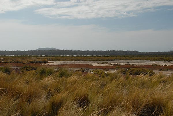
The 2012 D’Entrecasteaux Channel and lower Huon Estuary ‘State of the Waterway’ report provided baseline data from 1999 to 2011. The 2015 D’Entrecasteaux Channel and lower Huon Estuary report compiled updated system-wide data from 2012 to 2014. This 2017 ‘Report Card’ summarises data collected by our partners, as well as other relevant information collected during 2015 – 2017.

Acknowledgements

Many people have helped development this Report Card, particularly Karen Parsons of Ecomarine Consulting and the members of the D'Entrecasteaux and Huon Collaboration Steering Committee and Scientific and Technical Working Group.

Key stakeholders of the D'Entrecasteaux Channel and Huon Estuary are also acknowledged for their input into the Report Card.

The following information sources compiled by members of the Collaboration and other stakeholders are summarised in the Report Card:

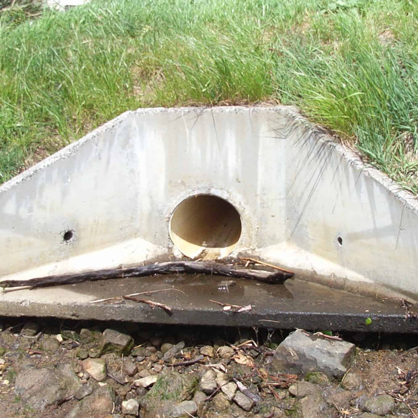
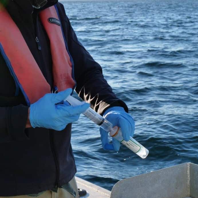
  • BEMP water and sediment quality sampling;
  • Recreational water quality testing during summer months;
  • River flow monitoring;
  • Sewage and industrial wastewater effluent monitoring;
  • Shellfish Market Access Program (ShellMAP) revoked classification notices regarding growing area closures;
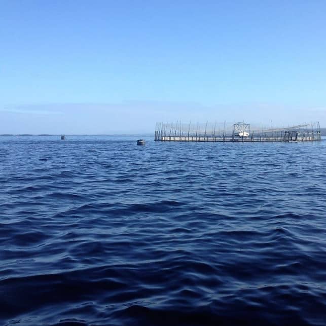
  • Finfish farming and processing nutrient input data;
  • Marine debris surveys and records;
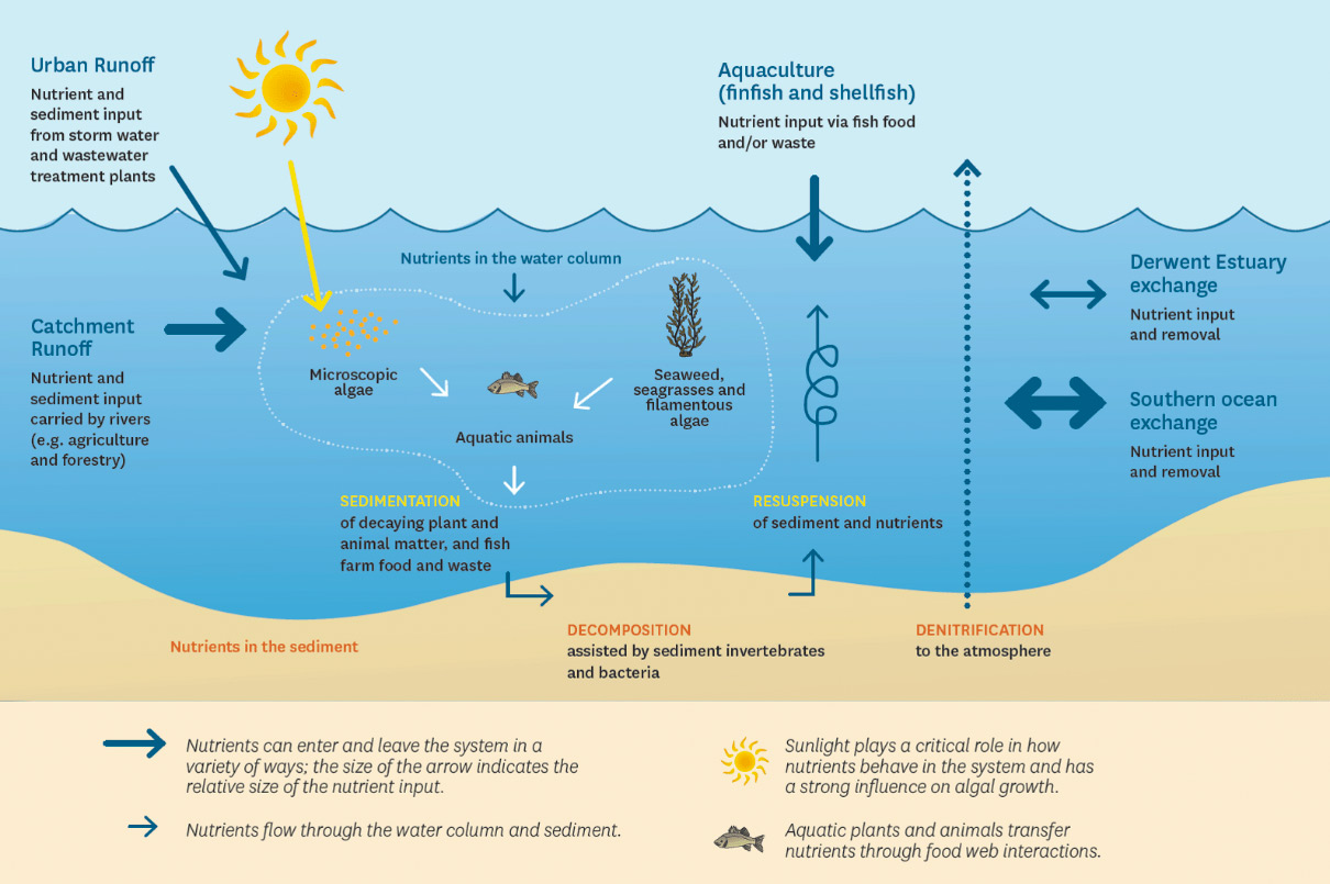
  • Waterway nutrient modelling and other system research;
  • Biosecurity monitoring and education programs;
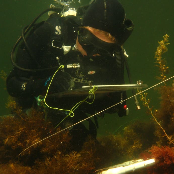
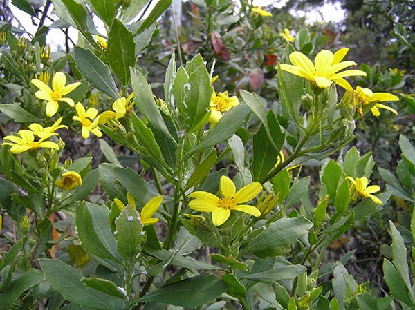
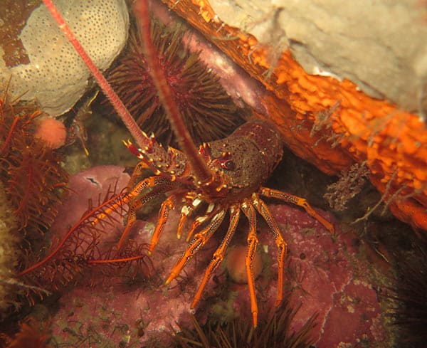
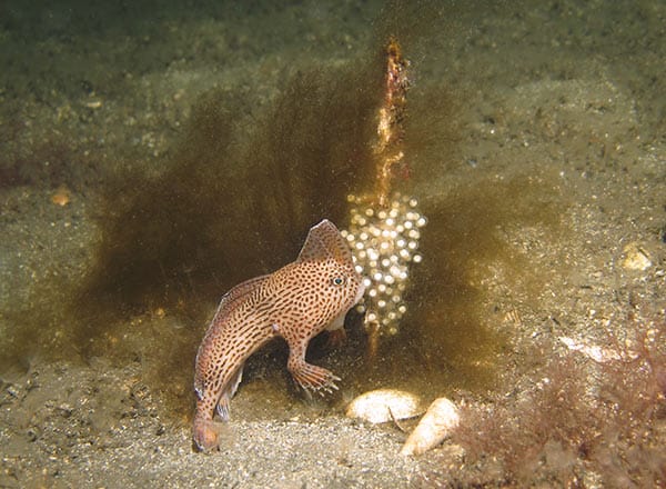
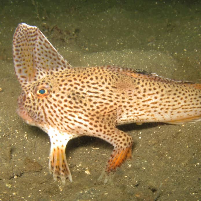
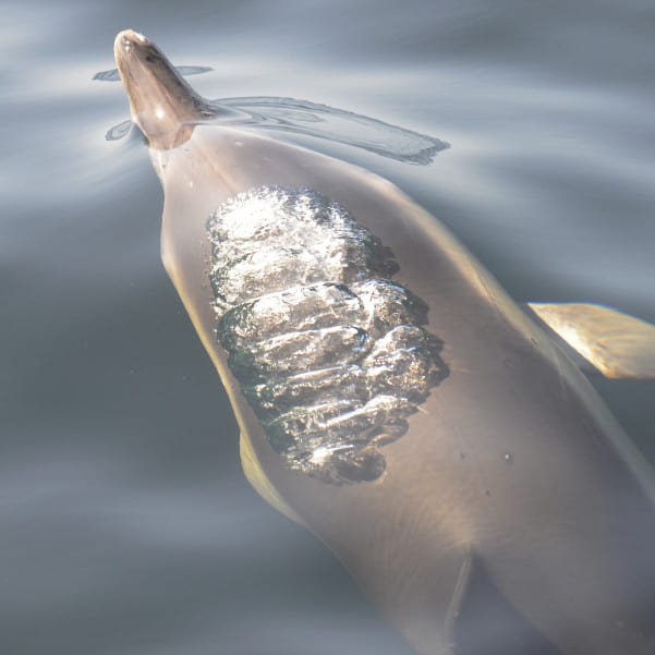
  • Habitat and biological surveys (e.g. spotted handfish, reef ecology, wildlife interactions, introduced species);
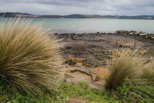
  • Coastal (climate) hazard and adaptation assessments, and shoreline monitoring programs;
  • Recreational boater licence and moorings records, and fisher surveys;
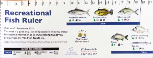
  • Fisheries research and stock assessments;
  • The Tasmanian visitor survey;
  • Community reporting and citizen science initiatives; and
  • Environmental management initiatives (e.g. reserve data, management strategies).

Resources

For further information, please contact:

D'Entrecasteaux and Huon Collaboration
NRM South
PO Box 425, South Hobart, TAS, 7004
Office location: 313 Macquarie St, Hobart
ourwaterway.com.au